GEFIS Gewerbeflächen-Informationssystem
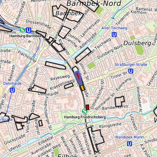
Krausestraße (Krausestraße / nördl. Dehnhaide) at Hamburg, Freie und Hansestadt Hamburg

Legend
Availabilities
Immediately
short term (2 years)
medium term (2-5 years)
long-term (> 5 years)
optional area (bindingly reserved)
occupational pension plan
not available
Brief description
Description of the parcel
Krausestraße
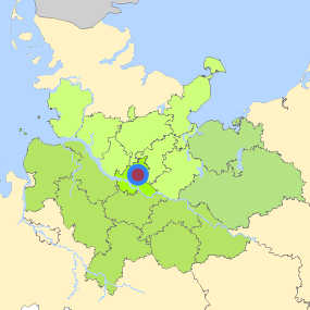
Municapility/city
Hamburg
Parcel
Property size (m²)
8,200
Availability
immediately available
focus use
other usage
further use
unavailable
Legal planning situation
Commercial space secured by planning permission
Yes
Building area according to land use plan
commercial building area
Existing planning law
§30 BauGB (qualified development plan)
Type and extent of building and land use
Specific type of structural use
GE
Development situation
fully accessible
24-hour operation
No
possible site occupancy ratio
No information
possible floor area figure
No information
possible number of full floors
No information
possible height of building structures
No information
cubic index
No information
Exclusions/restrictions of land use
restrictions to mobilization
Not specified
Infrastructur of site
broadband availability (at least 50 MBit/s)
Yes
quay edge
No
quay edge with sea-going vessel deep water
No
direct rail connection
Yes
electricity connection
Yes
gas connection
Not specified
water connection
Yes
wastewater connection
Yes
Proprietary situation and marketing intention
proprietary situation
Public
Detailed information about commercial zone
Gross surface area (ha)
2.2262
Sector focus
business-related services
research and development
Type of location of commercial estate
location for knowledge-oriented industry and services
Transport accessibility
Motorway
A 24
2.4
km
Motorway
A 255
7.7
km
Motorway
A 1
8.5
km
Motorway
A 252
9.0
km
Motorway
A 25
10.2
km
Motorway
A 7
10.5
km
Motorway
A 253
13.4
km
Motorway
A 23
13.5
km
Motorway
A 261
22.4
km
Main road
Ring 2
0.9
km
Main road
B 5
2.6
km
Main road
B 75
2.9
km
International airport
Flughafen Hamburg
7.6
km
International airport
Flughafen Bremen
117.1
km
International airport
Flughafen Hannover
141.3
km
Regional airport
Flughafen Lübeck
55.3
km
Regional airport
Cuxhaven
118.8
km
Regional airport
Schwerin-Parchim
126.0
km
Commercial airfield
Uetersen/Heist
34.3
km
Commercial airfield
Hartenholm
43.0
km
Commercial airfield
Neumünster
61.9
km
Commercial airfield
Hungriger Wolf
66.1
km
Commercial airfield
Rotenburg (Wümme)
77.7
km
Port
Seehafen FHH
17.4
km
Port
Binnenhafen Geesthacht
28.6
km
Port
Binnenhafen Lauenburg
44.2
km
Port
Binnenhafen Mölln
46.8
km
Port
Binnenhafen Lüneburg
53.7
km
Rail freight traffic
Emons Spedition GmbH
9.8
km
Rail freight traffic
Lübeck Nordlandkai (trimodal)
57.8
km
Rail freight traffic
Lübeck Konstinkai
59.2
km
Intermodal terminal
O'Swaldkai (FHH, trimodal)
8.0
km
Intermodal terminal
Süd-West Terminal (FHH, trimodal)
10.8
km
Intermodal terminal
DUSS Terminal Hamburg Billwerder (FHH)
13.6
km
Rail passenger transport
Friedrichsberg S
0.5
km
Rail passenger transport
Straßburger Straße U
0.9
km
Rail passenger transport
Alter Teichweg U
1.1
km
Rail passenger transport
Dehnhaide U
1.1
km
Rail passenger transport
Wandsbeker Chaussee SU
1.1
km
Public transport
Hamburg Krausestraße
0.1
km
Public transport
Hamburg Straßburger Platz
0.4
km
Public transport
Hamburg Olivaer Straße
0.5
km
Public transport
Hamburg Friedrichsberg
0.5
km
Availability of public transport
Not specified
Information about Hamburg
Inhabitants of the municipality
1,852,478
Trade tax rate
470
Property tax B
540
Contact
Stefan WieschebrockHamburg Invest
Bereichsleitung
Wexstr. 7
20355 Hamburg
Contact
Stefan WieschebrockHamburg Invest
Bereichsleitung
Wexstr. 7
20355 Hamburg