GEFIS Gewerbeflächen-Informationssystem
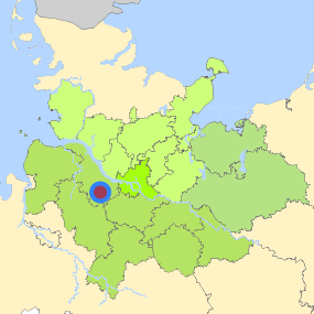
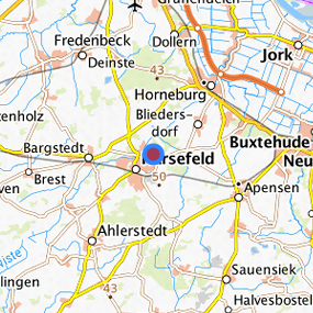
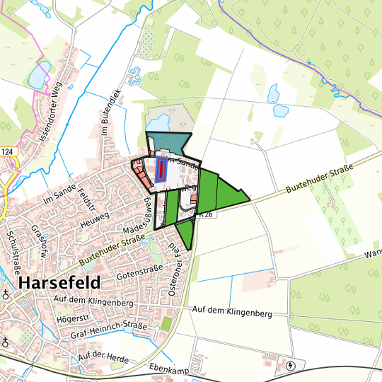
Buxtehuder Straße/Im Sande bzw. Klaus-Ahrens-Straße in Harsefeld (135) at Harsefeld, Landkreis Stade
Legend
Availabilities
Immediately
short term (2 years)
medium term (2-5 years)
long-term (> 5 years)
optional area (bindingly reserved)
occupational pension plan
not available
Brief description
Description of the parcel
Buxtehuder Straße/Im Sande bzw. Klaus-Ahrens-Straße in Harsefeld
Municapility/city
Harsefeld
Parcel
Property size (m²)
8,971.43
Availability
immediately available
focus use
other usage
further use
unavailable
Legal planning situation
Commercial space secured by planning permission
Yes
Building area according to land use plan
commercial building area
Existing planning law
§30 BauGB (qualified development plan)
Type and extent of building and land use
Specific type of structural use
GE
Development situation
fully accessible
24-hour operation
Not specified
possible site occupancy ratio
0.8
possible floor area figure
1.6
possible number of full floors
No information
possible height of building structures
No information
cubic index
9
Exclusions/restrictions of land use
restrictions to mobilization
Not specified
Infrastructur of site
broadband availability (at least 50 MBit/s)
No
quay edge
No
quay edge with sea-going vessel deep water
No
direct rail connection
No
electricity connection
Yes
gas connection
Yes
water connection
Yes
wastewater connection
Yes
Proprietary situation and marketing intention
proprietary situation
Public
Detailed information about commercial zone
Gross surface area (ha)
34.20
Sector focus
mixed sector structure
Type of location of commercial estate
classic commercial estate
Transport accessibility
Motorway
A 26
9.5
km
Motorway
A 1
21.3
km
Motorway
A 7
29.9
km
Motorway
A 261
31.2
km
Motorway
A 253
35.2
km
Motorway
A 252
41.5
km
Motorway
A 39
42.5
km
Motorway
A 255
42.9
km
Motorway
A 25
44.6
km
Motorway
A 23
46.8
km
Motorway
A 24
48.6
km
Main road
B 73
9.1
km
Main road
B 3
17.7
km
Main road
B 74
18.9
km
International airport
Flughafen Hamburg
51.9
km
International airport
Flughafen Bremen
76.2
km
International airport
Flughafen Hannover
127.4
km
Regional airport
Cuxhaven
83.7
km
Regional airport
Flughafen Lübeck
103.4
km
Commercial airfield
Rotenburg (Wümme)
45.1
km
Commercial airfield
Weser-Wümme
57.1
km
Commercial airfield
Uetersen/Heist
63.2
km
Commercial airfield
Hungriger Wolf
82.8
km
Commercial airfield
St. Michaelisdonn
85.1
km
Port
Seehafen Stade-Bützfleth
25.1
km
Port
Seehafen FHH
32.3
km
Port
Seehafen Gückstadt
56.5
km
Port
Binnenhafen Geesthacht
67.1
km
Port
Binnenhafen Itzehoe
73.3
km
Rail freight traffic
Emons Spedition GmbH
44.2
km
Intermodal terminal
Industriebahnhof Stade-Brunshausen
22.5
km
Intermodal terminal
Holborn Raffinerie (FHH, trimodal)
32.1
km
Intermodal terminal
Hansaport Terminal (FHH, trimodal)
33.4
km
Rail passenger transport
Harsefeld
2.3
km
Rail passenger transport
Ruschwedel
4.6
km
Rail passenger transport
Bargstedt
6.5
km
Rail passenger transport
Apensen
7.6
km
Rail passenger transport
Horneburg
8.8
km
Public transport
Harsefeld Hellwege-Allee
0.7
km
Public transport
Harsefeld K 26/Gasebergabestation
0.8
km
Public transport
Harsefeld Roggenkamp
0.9
km
Availability of public transport
Available
Information about Harsefeld
GDP per capita (in €)
(district level)
30,977.00
Rate of unemployment (in %)
(district level)
6.40
Inhabitants of the municipality
12,636
Trade tax rate
410
Property tax B
420
Contact
Torben VagtsSamtgemeinde Harsefeld
Fachbereichsleiter II - Finanzen
Herrenstraße 25
21698 Harsefeld
Contact
Torben VagtsSamtgemeinde Harsefeld
Fachbereichsleiter II - Finanzen
Herrenstraße 25
21698 Harsefeld