GEFIS Gewerbeflächen-Informationssystem
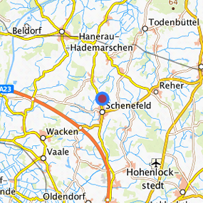
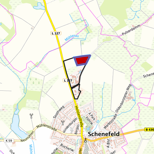
Industrie- Gewerbegebiet Nord (Pulser Damm II) at Schenefeld, Kreis Steinburg
Legend
Availabilities
Immediately
short term (2 years)
medium term (2-5 years)
long-term (> 5 years)
optional area (bindingly reserved)
occupational pension plan
not available
Brief description
Description of the parcel
Industrie- Gewerbegebiet Nord
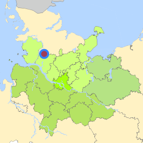
Municapility/city
Schenefeld
Parcel
Property size (m²)
34,874
Availability
immediately available
focus use
grassland
further use
grassland
Legal planning situation
Commercial space secured by planning permission
Yes
Building area according to land use plan
commercial building area
Existing planning law
§30 BauGB (qualified development plan)
Type and extent of building and land use
Specific type of structural use
GI
Development situation
not accessible
24-hour operation
Not specified
possible site occupancy ratio
0.6
possible floor area figure
Not fixed
possible number of full floors
Not fixed
possible height of building structures
8
cubic index
3.5
Exclusions/restrictions of land use
restrictions to mobilization
building law
Infrastructur of site
broadband availability (at least 50 MBit/s)
Yes
quay edge
No
quay edge with sea-going vessel deep water
No
direct rail connection
No
electricity connection
Yes
gas connection
Yes
water connection
Yes
wastewater connection
Yes
Proprietary situation and marketing intention
proprietary situation
Private
Detailed information about commercial zone
Gross surface area (ha)
18.00
Sector focus
construction industry
trade, maintenance and repair of motor vehicles
machinery and vehicle construction
Type of location of commercial estate
classic commercial estate
Transport accessibility
Motorway
A 23
5.3
km
Motorway
A 7
33.3
km
Motorway
A 215
41.7
km
Motorway
A 210
51.6
km
Motorway
A 21
53.3
km
Main road
B 430
1.5
km
Main road
B 77
10.4
km
International airport
Flughafen Hamburg
69.7
km
International airport
Flughafen Bremen
145.3
km
Regional airport
Cuxhaven
80.5
km
Regional airport
Flughafen Lübeck
100.0
km
Commercial airfield
Hungriger Wolf
15.5
km
Commercial airfield
St. Michaelisdonn
29.4
km
Commercial airfield
Neumünster
36.1
km
Commercial airfield
Hartenholm
48.3
km
Commercial airfield
Heide-Büsum
48.6
km
Port
Binnenhafen Itzehoe
16.5
km
Port
Seehafen Brunsbüttel
31.8
km
Port
Seehafen Rendsburg
35.9
km
Port
Seehafen Gückstadt
36.6
km
Port
Landeshafen Büsum
48.1
km
Rail freight traffic
Emons Spedition GmbH
78.6
km
Rail freight traffic
Lübeck Nordlandkai (trimodal)
94.1
km
Rail freight traffic
Lübeck Konstinkai
95.5
km
Intermodal terminal
Terminal Brunsbüttel (trimodal)
34.0
km
Intermodal terminal
Terminal Neumünster
38.4
km
Intermodal terminal
Terminal Cuxhaven (trimodal)
66.7
km
Rail passenger transport
Gokels
7.1
km
Rail passenger transport
Beringstedt
8.5
km
Rail passenger transport
Hademarschen
9.9
km
Rail passenger transport
Osterstedt
10.7
km
Rail passenger transport
Beldorf
13.9
km
Public transport
Schenefeld(Mittelholst) Nord
0.9
km
Availability of public transport
Available
Information about Schenefeld
GDP per capita (in €)
(district level)
31,824.00
Rate of unemployment (in %)
(district level)
4.90
Contact
Christian HolstEntwicklungsgesellschaft Westholstein mbH
Wirtschaftsförderer
Contact
Christian HolstEntwicklungsgesellschaft Westholstein mbH
Wirtschaftsförderer