GEFIS Gewerbeflächen-Informationssystem
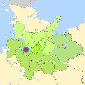
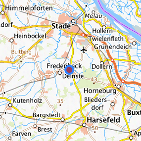
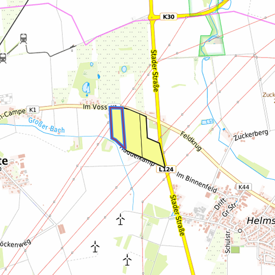
An den Rehnen (Gemarkung Helmste, Flur 1, 60/1) at Deinste, Landkreis Stade
Legend
Availabilities
Immediately
short term (2 years)
medium term (2-5 years)
long-term (> 5 years)
optional area (bindingly reserved)
occupational pension plan
not available
Brief description
Description of the parcel
An den Rehnen
Municapility/city
Deinste
Parcel
Property size (m²)
36,401
Availability
available in the long-term
focus use
agriculture
further use
unavailable
Legal planning situation
Commercial space secured by planning permission
No
Building area according to land use plan
planning law not secured
Existing planning law
planning law not secured
Type and extent of building and land use
Specific type of structural use
GE
Development situation
not accessible
24-hour operation
Not specified
possible site occupancy ratio
Not fixed
possible floor area figure
Not fixed
possible number of full floors
Not fixed
possible height of building structures
Not fixed
cubic index
Not fixed
Exclusions/restrictions of land use
restrictions to mobilization
None
Infrastructur of site
broadband availability (at least 50 MBit/s)
Not specified
quay edge
Not specified
quay edge with sea-going vessel deep water
Not specified
direct rail connection
Not specified
electricity connection
Not specified
gas connection
Not specified
water connection
Not specified
wastewater connection
Not specified
Proprietary situation and marketing intention
proprietary situation
Private
Detailed information about commercial zone
Gross surface area (ha)
14.7776
Sector focus
food industry
Type of location of commercial estate
classic commercial estate
Transport accessibility
Motorway
A 26
8.3
km
Motorway
A 1
29.7
km
Motorway
A 7
34.0
km
Motorway
A 261
35.3
km
Motorway
A 253
39.3
km
Motorway
A 252
44.8
km
Motorway
A 255
45.0
km
Motorway
A 39
46.6
km
Motorway
A 25
48.8
km
Motorway
A 23
48.9
km
Motorway
A 24
50.7
km
Main road
B 73
6.8
km
Main road
B 74
9.1
km
International airport
Flughafen Hamburg
54.0
km
International airport
Flughafen Bremen
83.7
km
International airport
Flughafen Hannover
135.3
km
Regional airport
Cuxhaven
75.3
km
Regional airport
Flughafen Lübeck
106.1
km
Commercial airfield
Rotenburg (Wümme)
52.9
km
Commercial airfield
Weser-Wümme
64.6
km
Commercial airfield
Uetersen/Heist
65.3
km
Commercial airfield
Hungriger Wolf
72.9
km
Commercial airfield
St. Michaelisdonn
75.3
km
Port
Seehafen Stade-Bützfleth
15.3
km
Port
Seehafen FHH
34.5
km
Port
Seehafen Gückstadt
46.6
km
Port
Binnenhafen Itzehoe
63.4
km
Port
Seehafen Brunsbüttel
67.1
km
Rail freight traffic
Emons Spedition GmbH
47.4
km
Intermodal terminal
Industriebahnhof Stade-Brunshausen
12.6
km
Intermodal terminal
Hansaport Terminal (FHH, trimodal)
35.5
km
Intermodal terminal
Containerterminal Altenwerder (FHH, trimodal)
36.3
km
Rail passenger transport
Dollern S
8.0
km
Rail passenger transport
Agathenburg S
8.1
km
Rail passenger transport
Horneburg
8.3
km
Rail passenger transport
Stade
8.9
km
Rail passenger transport
Harsefeld
9.8
km
Public transport
Helmste Feldkrug
0.7
km
Public transport
Helmste Stader Strahe
0.7
km
Public transport
Helmste K 44
0.8
km
Public transport
Helmste Zuckerberg
1.0
km
Availability of public transport
Available
Information about Deinste
GDP per capita (in €)
(district level)
30,977.00
Rate of unemployment (in %)
(district level)
6.40
Inhabitants of the municipality
1,991
Trade tax rate
360
Property tax B
400
Contact
Katrin HinschSamtgemeinde Fredenbeck, Fachbereich 4 Bauen
Schwingestraße 1
21717 Fredenbeck
Contact
Katrin HinschSamtgemeinde Fredenbeck, Fachbereich 4 Bauen
Schwingestraße 1
21717 Fredenbeck