GEFIS Gewerbeflächen-Informationssystem
Fischbeker Reethen (Fischbeker Reethen) at Hamburg, Freie und Hansestadt Hamburg


Legend
Availabilities
Immediately
short term (2 years)
medium term (2-5 years)
long-term (> 5 years)
optional area (bindingly reserved)
occupational pension plan
not available
Brief description
Description of the parcel
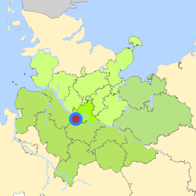
Fischbeker Reethen
Municapility/city
Hamburg
Parcel
Property size (m²)
126,700
Availability
available in the medium-term
focus use
agriculture
further use
unavailable
Legal planning situation
Commercial space secured by planning permission
Yes
Building area according to land use plan
commercial building area
Existing planning law
§30 BauGB (unqualified development plan)
Type and extent of building and land use
Specific type of structural use
Other
Development situation
partially accessible
24-hour operation
Not specified
possible site occupancy ratio
No information
possible floor area figure
No information
possible number of full floors
No information
possible height of building structures
No information
cubic index
No information
Exclusions/restrictions of land use
restrictions to mobilization
Not specified
Infrastructur of site
broadband availability (at least 50 MBit/s)
Yes
quay edge
No
quay edge with sea-going vessel deep water
No
direct rail connection
Yes
electricity connection
Yes
gas connection
Not specified
water connection
Yes
wastewater connection
Yes
Proprietary situation and marketing intention
proprietary situation
Public
Detailed information about commercial zone
Gross surface area (ha)
20.4557
Sector focus
Not known
Type of location of commercial estate
location for knowledge-oriented industry and services
location for crafts and small-scale trades
Transport accessibility
Motorway
A 7
8.2
km
Motorway
A 1
12.1
km
Motorway
A 261
12.4
km
Motorway
A 253
13.5
km
Motorway
A 26
14.5
km
Motorway
A 252
19.9
km
Motorway
A 255
21.7
km
Motorway
A 39
21.7
km
Motorway
A 25
23.0
km
Motorway
A 23
25.7
km
Motorway
A 24
27.5
km
Main road
B 73
0.3
km
Main road
B 3
4.6
km
International airport
Flughafen Hamburg
30.8
km
International airport
Flughafen Bremen
93.2
km
International airport
Flughafen Hannover
121.7
km
Regional airport
Flughafen Lübeck
81.7
km
Regional airport
Cuxhaven
99.3
km
Regional airport
Schwerin-Parchim
148.2
km
Commercial airfield
Uetersen/Heist
42.1
km
Commercial airfield
Rotenburg (Wümme)
54.1
km
Commercial airfield
Hartenholm
64.5
km
Commercial airfield
Weser-Wümme
69.2
km
Commercial airfield
Hungriger Wolf
78.5
km
Port
Seehafen FHH
11.3
km
Port
Seehafen Stade-Bützfleth
36.4
km
Port
Binnenhafen Geesthacht
45.5
km
Port
Binnenhafen Lüneburg
57.1
km
Port
Binnenhafen Lauenburg
61.2
km
Rail freight traffic
Emons Spedition GmbH
22.5
km
Rail freight traffic
Lübeck Nordlandkai (trimodal)
85.4
km
Rail freight traffic
Lübeck Konstinkai
86.8
km
Intermodal terminal
Holborn Raffinerie (FHH, trimodal)
10.5
km
Intermodal terminal
Hansaport Terminal (FHH, trimodal)
12.3
km
Intermodal terminal
Containerterminal Altenwerder (FHH, trimodal)
12.6
km
Rail passenger transport
Fischbek S
1.5
km
Rail passenger transport
Neu Wulmstorf S
3.1
km
Rail passenger transport
Neugraben S
3.2
km
Rail passenger transport
Neuwiedenthal S
5.1
km
Rail passenger transport
Buxtehude
9.8
km
Public transport
Hamburg-Fischbek Kaserne
0.7
km
Public transport
Neu Wulmstorf(Niederelbe) Pflegeheim Am Vossberg
0.8
km
Public transport
Neu Wulmstorf Im Fischbeker Heidbrook (West)
0.8
km
Public transport
Hamburg-Fischbek Neckersstücken
0.9
km
Availability of public transport
Not specified
Information about Hamburg
Inhabitants of the municipality
1,852,478
Trade tax rate
470
Property tax B
540
Contact
Stefan WieschebrockHamburg Invest
Bereichsleitung
Wexstr. 7
20355 Hamburg
Contact
Stefan WieschebrockHamburg Invest
Bereichsleitung
Wexstr. 7
20355 Hamburg