GEFIS Gewerbeflächen-Informationssystem
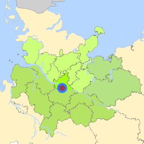
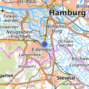
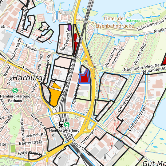
Bahnhofslinse/ Schlachthofstraße (Bahnhofslinse / Schlachthofstraße (Nord)) at Hamburg, Freie und Hansestadt Hamburg
Legend
Availabilities
Immediately
short term (2 years)
medium term (2-5 years)
long-term (> 5 years)
optional area (bindingly reserved)
occupational pension plan
not available
Brief description
Description of the parcel
Bahnhofslinse/ Schlachthofstraße
Municapility/city
Hamburg
Parcel
Property size (m²)
20,300
Availability
immediately available
focus use
brownfield site
further use
unavailable
Legal planning situation
Commercial space secured by planning permission
Yes
Building area according to land use plan
commercial building area
Existing planning law
§30 BauGB (qualified development plan)
Type and extent of building and land use
Specific type of structural use
GE
Development situation
fully accessible
24-hour operation
No
possible site occupancy ratio
No information
possible floor area figure
No information
possible number of full floors
No information
possible height of building structures
No information
cubic index
No information
Exclusions/restrictions of land use
restrictions to mobilization
Others
Infrastructur of site
broadband availability (at least 50 MBit/s)
Yes
quay edge
No
quay edge with sea-going vessel deep water
No
direct rail connection
No
electricity connection
Yes
gas connection
Not specified
water connection
Yes
wastewater connection
Yes
Proprietary situation and marketing intention
proprietary situation
Public
Detailed information about commercial zone
Gross surface area (ha)
9.1156
Sector focus
research and development
Type of location of commercial estate
location for knowledge-oriented industry and services
Transport accessibility
Motorway
A 253
0.3
km
Motorway
A 1
2.7
km
Motorway
A 7
6.2
km
Motorway
A 252
6.6
km
Motorway
A 261
6.9
km
Motorway
A 255
8.5
km
Motorway
A 25
10.1
km
Motorway
A 39
11.5
km
Motorway
A 24
14.4
km
Motorway
A 23
20.8
km
Main road
B 73
0.9
km
Main road
B 4
2.0
km
Main road
B 75
2.1
km
International airport
Flughafen Hamburg
20.9
km
International airport
Flughafen Bremen
101.6
km
International airport
Flughafen Hannover
125.8
km
Regional airport
Flughafen Lübeck
68.9
km
Regional airport
Cuxhaven
111.5
km
Regional airport
Schwerin-Parchim
135.4
km
Commercial airfield
Uetersen/Heist
40.1
km
Commercial airfield
Hartenholm
56.9
km
Commercial airfield
Rotenburg (Wümme)
62.2
km
Commercial airfield
Uelzen
73.1
km
Commercial airfield
Hungriger Wolf
74.7
km
Port
Seehafen FHH
10.0
km
Port
Binnenhafen Geesthacht
32.8
km
Port
Binnenhafen Lüneburg
46.2
km
Port
Seehafen Stade-Bützfleth
48.2
km
Port
Binnenhafen Lauenburg
48.5
km
Rail freight traffic
Emons Spedition GmbH
9.6
km
Rail freight traffic
Lübeck Nordlandkai (trimodal)
72.5
km
Rail freight traffic
Lübeck Konstinkai
73.9
km
Intermodal terminal
Terminal Wallmann (FHH, trimodal)
3.6
km
Intermodal terminal
Holborn Raffinerie (FHH, trimodal)
3.6
km
Intermodal terminal
Tanklager Shell AG (FHH trimodal)
3.7
km
Rail passenger transport
Hamburg-Harburg S
1.0
km
Rail passenger transport
Harburg Rathaus S
1.8
km
Rail passenger transport
Heimfeld S
3.1
km
Rail passenger transport
Wilhelmsburg S
5.0
km
Rail passenger transport
Meckelfeld
5.9
km
Public transport
Hamburg Schlachthofstrate Nord
0.0
km
Public transport
Hamburg Schlachthofstrate Sed
0.4
km
Public transport
Hamburg Nartenstra
0.6
km
Public transport
Hamburg-Harburg
0.7
km
Availability of public transport
Not specified
Information about Hamburg
Inhabitants of the municipality
1,852,478
Trade tax rate
470
Property tax B
540
Contact
Stefan WieschebrockHamburg Invest
Bereichsleitung
Wexstr. 7
20355 Hamburg
Contact
Stefan WieschebrockHamburg Invest
Bereichsleitung
Wexstr. 7
20355 Hamburg