GEFIS Gewerbeflächen-Informationssystem

Gewerbegebiet Mittelsdorf (Gewerbegebiet Hammah) at Hammah, Landkreis Stade
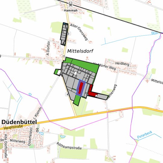
Location in the Hamburg Metropolitan Region
Location in the requested region
Detailed view of the requested site

Legend

Availabilities
Immediately
short term (2 years)
medium term (2-5 years)
long-term (> 5 years)
optional area (bindingly reserved)
occupational pension plan
not available

Brief description

Description of the parcel
Gewerbegebiet Mittelsdorf
Municapility/city
Hammah

Parcel

Property size (m²)
22,985.96
Availability
immediately available
focus use
agriculture
further use
unavailable

Legal planning situation

Commercial space secured by planning permission
Yes
Building area according to land use plan
commercial building area
Existing planning law
§30 BauGB (qualified development plan)

Type and extent of building and land use

Specific type of structural use
GE
Development situation
partially accessible
24-hour operation
Not specified
possible site occupancy ratio
0.6
possible floor area figure
0.8
possible number of full floors
2
possible height of building structures
12
cubic index
No information

Exclusions/restrictions of land use

restrictions to mobilization
Not specified

Infrastructur of site

broadband availability (at least 50 MBit/s)
Yes
quay edge
No
quay edge with sea-going vessel deep water
No
direct rail connection
No
electricity connection
Yes
gas connection
Yes
water connection
Yes
wastewater connection
Yes

Proprietary situation and marketing intention

proprietary situation
Private

Links to the parcel

Detailed information about commercial zone

Gross surface area (ha)
42.2261
Sector focus
mixed sector structure
Type of location of commercial estate
Not specified

Transport accessibility

Motorway
A 26
10.1  km
Motorway
A 1
41.0  km
Motorway
A 7
42.6  km
Motorway
A 261
47.3  km
Motorway
A 23
49.2  km
Motorway
A 253
49.5  km
Motorway
A 252
52.3  km
Motorway
A 255
52.6  km
Motorway
A 27
53.9  km
Motorway
A 25
57.2  km
Main road
B 73
0.8  km
Main road
B 74
5.0  km
International airport
Flughafen Hamburg
61.6  km
International airport
Flughafen Bremen
85.7  km
International airport
Flughafen Hannover
145.9  km
Regional airport
Cuxhaven
61.4  km
Regional airport
Flughafen Lübeck
113.6  km
Commercial airfield
Hungriger Wolf
62.0  km
Commercial airfield
Rotenburg (Wümme)
62.2  km
Commercial airfield
St. Michaelisdonn
64.4  km
Commercial airfield
Uetersen/Heist
69.0  km
Commercial airfield
Weser-Wümme
71.5  km
Port
Seehafen Stade-Bützfleth
13.2  km
Port
Seehafen Gückstadt
35.7  km
Port
Seehafen FHH
42.0  km
Port
Binnenhafen Itzehoe
52.5  km
Port
Seehafen Brunsbüttel
56.2  km
Rail freight traffic
Emons Spedition GmbH
54.9  km
Intermodal terminal
Industriebahnhof Stade-Brunshausen
11.1  km
Intermodal terminal
Hansaport Terminal (FHH, trimodal)
43.0  km
Intermodal terminal
Containerterminal Altenwerder (FHH, trimodal)
43.8  km
Rail passenger transport
Hammah
1.4  km
Rail passenger transport
Himmelpforten
5.5  km
Rail passenger transport
Stade
8.9  km
Rail passenger transport
Hechthausen
12.0  km
Rail passenger transport
Agathenburg S
12.9  km
Public transport
Mittelsdorf Himmelpfortener Weg
0.4  km
Public transport
Mittelsdorf Hauptstrafe 4
0.4  km
Public transport
Mittelsdorf Wendeplatz
0.5  km
Public transport
Grefenmoor Abzweig Hammah
0.7  km
Availability of public transport
Available

Links to the commercial zone

Information about Hammah

GDP per capita (in €) (district level)
30,977.00
Rate of unemployment (in %) (district level)
6.40
Inhabitants of the municipality
2,922
Trade tax rate
390
Property tax B
400

Contact

Holger Falcke
Samtgemeinde Oldendorf-Himmelpforten
Samtgemeindebürgermeister
Mittelweg 2
21709 Himmelpforten
PDF (German) PDF (English) Close Factsheet

Contact

Holger Falcke
Samtgemeinde Oldendorf-Himmelpforten
Samtgemeindebürgermeister
Mittelweg 2
21709 Himmelpforten