GEFIS Gewerbeflächen-Informationssystem
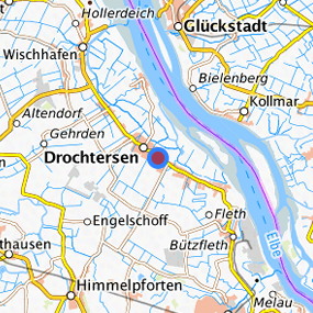
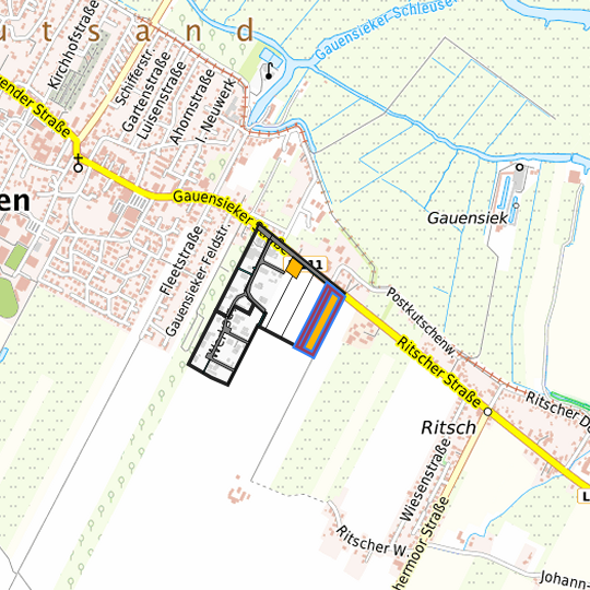
Gauensiek-Süd (BPlan 19) (11) at Drochtersen, Landkreis Stade
Legend
Availabilities
Immediately
short term (2 years)
medium term (2-5 years)
long-term (> 5 years)
optional area (bindingly reserved)
occupational pension plan
not available
Brief description
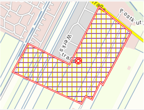
Description of the parcel
Gauensiek-Süd (BPlan 19)
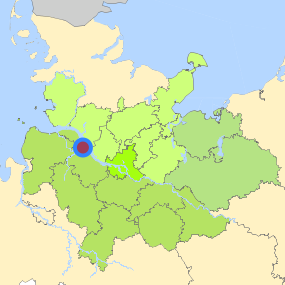
Municapility/city
Drochtersen
Parcel
Property size (m²)
21,066.41
Availability
available in the medium-term
focus use
agriculture
further use
unavailable
Legal planning situation
Commercial space secured by planning permission
Yes
Building area according to land use plan
commercial building area
Existing planning law
§30 BauGB (qualified development plan)
Type and extent of building and land use
Specific type of structural use
GE
Development situation
not accessible
24-hour operation
Yes
possible site occupancy ratio
0.8
possible floor area figure
1.4
possible number of full floors
2
possible height of building structures
7.5
cubic index
Not fixed
Exclusions/restrictions of land use
restrictions to mobilization
None
Infrastructur of site
broadband availability (at least 50 MBit/s)
No
quay edge
No
quay edge with sea-going vessel deep water
No
direct rail connection
No
electricity connection
No
gas connection
No
water connection
No
wastewater connection
No
Proprietary situation and marketing intention
proprietary situation
Private
Detailed information about commercial zone
Gross surface area (ha)
11.7325
Sector focus
mixed sector structure
Type of location of commercial estate
classic commercial estate
Transport accessibility
Motorway
A 26
18.8
km
Motorway
A 23
36.2
km
Motorway
A 1
49.9
km
Motorway
A 7
49.9
km
Motorway
A 261
55.3
km
Motorway
A 27
56.2
km
Motorway
A 253
57.1
km
Motorway
A 252
59.7
km
Motorway
A 255
60.0
km
Main road
B 495
8.3
km
Main road
B 73
14.7
km
Main road
B 74
17.2
km
International airport
Flughafen Hamburg
68.9
km
International airport
Flughafen Bremen
98.0
km
Regional airport
Cuxhaven
61.2
km
Regional airport
Flughafen Lübeck
120.4
km
Commercial airfield
Hungriger Wolf
49.0
km
Commercial airfield
St. Michaelisdonn
51.3
km
Commercial airfield
Uetersen/Heist
56.0
km
Commercial airfield
Hartenholm
71.0
km
Commercial airfield
Rotenburg (Wümme)
76.4
km
Port
Seehafen Stade-Bützfleth
10.1
km
Port
Seehafen Gückstadt
22.7
km
Port
Seehafen Brunsbüttel
43.1
km
Port
Seehafen FHH
49.4
km
Rail freight traffic
Emons Spedition GmbH
62.3
km
Intermodal terminal
Industriebahnhof Stade-Brunshausen
14.5
km
Intermodal terminal
Terminal Brunsbüttel (trimodal)
43.4
km
Intermodal terminal
Hansaport Terminal (FHH, trimodal)
50.4
km
Rail passenger transport
Hammah
12.9
km
Rail passenger transport
Himmelpforten
13.9
km
Rail passenger transport
Stade
17.0
km
Rail passenger transport
Hemmoor
20.6
km
Rail passenger transport
Agathenburg S
20.8
km
Availability of public transport
Available
Photographs of the commercial zone
Information about Drochtersen
GDP per capita (in €)
(district level)
30,977.00
Rate of unemployment (in %)
(district level)
6.40
Inhabitants of the municipality
11,449
Trade tax rate
400
Property tax B
450
Links to the location
Contact
Mike EckhoffGemeinde Drochtersen
Bürgermeister
Sietwender Straße 27
21706 Drochtersen
Contact
Mike EckhoffGemeinde Drochtersen
Bürgermeister
Sietwender Straße 27
21706 Drochtersen