GEFIS Gewerbeflächen-Informationssystem
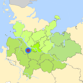
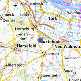
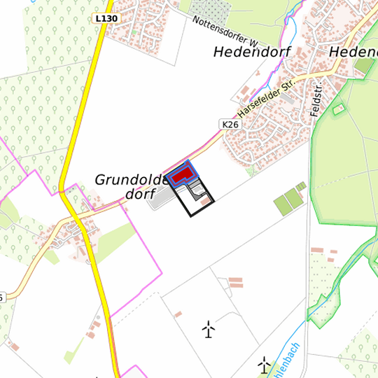
Buxtehude - Hedendorf (015) at Buxtehude, Landkreis Stade
Legend
Availabilities
Immediately
short term (2 years)
medium term (2-5 years)
long-term (> 5 years)
optional area (bindingly reserved)
occupational pension plan
not available
Brief description
Description of the parcel
Buxtehude - Hedendorf
Municapility/city
Buxtehude
Parcel
Property size (m²)
12,100.19
Availability
immediately available
focus use
brownfield site
further use
unavailable
Legal planning situation
Commercial space secured by planning permission
Yes
Building area according to land use plan
commercial building area
Existing planning law
§30 BauGB (qualified development plan)
Type and extent of building and land use
Specific type of structural use
GE
Development situation
fully accessible
24-hour operation
Yes
possible site occupancy ratio
0.8
possible floor area figure
No information
possible number of full floors
No information
possible height of building structures
No information
cubic index
No information
Exclusions/restrictions of land use
restrictions to mobilization
None
Infrastructur of site
broadband availability (at least 50 MBit/s)
Yes
quay edge
No
quay edge with sea-going vessel deep water
No
direct rail connection
No
electricity connection
Not specified
gas connection
Yes
water connection
Yes
wastewater connection
Yes
Proprietary situation and marketing intention
proprietary situation
Public
Detailed information about commercial zone
Gross surface area (ha)
4.9322
Sector focus
other manufacturing sectors
machinery and vehicle construction
Type of location of commercial estate
classic commercial estate
Transport accessibility
Motorway
A 26
5.8
km
Motorway
A 1
17.9
km
Motorway
A 7
23.9
km
Motorway
A 261
25.2
km
Motorway
A 253
29.2
km
Motorway
A 252
35.5
km
Motorway
A 39
36.5
km
Motorway
A 255
36.9
km
Motorway
A 25
38.6
km
Motorway
A 23
40.8
km
Motorway
A 24
42.6
km
Main road
B 73
3.1
km
Main road
B 3
11.7
km
International airport
Flughafen Hamburg
45.9
km
International airport
Flughafen Bremen
81.5
km
International airport
Flughafen Hannover
127.9
km
Regional airport
Cuxhaven
86.3
km
Regional airport
Flughafen Lübeck
97.4
km
Commercial airfield
Rotenburg (Wümme)
45.7
km
Commercial airfield
Uetersen/Heist
57.2
km
Commercial airfield
Weser-Wümme
61.1
km
Commercial airfield
Hartenholm
79.6
km
Commercial airfield
Hungriger Wolf
81.0
km
Port
Seehafen Stade-Bützfleth
23.3
km
Port
Seehafen FHH
26.3
km
Port
Seehafen Gückstadt
54.6
km
Port
Binnenhafen Geesthacht
61.1
km
Port
Binnenhafen Itzehoe
71.5
km
Rail freight traffic
Emons Spedition GmbH
38.1
km
Intermodal terminal
Industriebahnhof Stade-Brunshausen
20.7
km
Intermodal terminal
Holborn Raffinerie (FHH, trimodal)
26.1
km
Intermodal terminal
Hansaport Terminal (FHH, trimodal)
27.3
km
Rail passenger transport
Neukloster S
3.2
km
Rail passenger transport
Apensen
4.2
km
Rail passenger transport
Ruschwedel
5.5
km
Rail passenger transport
Horneburg
5.7
km
Rail passenger transport
Buxtehude
6.7
km
Public transport
Buxtehude-Hedendorf Fuhrenkamp
0.5
km
Public transport
Apensen Grundoldendorf 8
0.5
km
Availability of public transport
Available
Information about Buxtehude
GDP per capita (in €)
(district level)
30,977.00
Rate of unemployment (in %)
(district level)
6.40
Inhabitants of the municipality
39,792
Trade tax rate
410
Property tax B
415
Contact
Kerstin MaackHansestadt Buxtehude
Wirtschaftsförderin
Bahnhofstr. 7
21614 Buxtehude
Contact
Kerstin MaackHansestadt Buxtehude
Wirtschaftsförderin
Bahnhofstr. 7
21614 Buxtehude