GEFIS Gewerbeflächen-Informationssystem
Industriegebiet Klethener Weg (1/31) at Ahlerstedt, Landkreis Stade
Legend
Availabilities
Immediately
short term (2 years)
medium term (2-5 years)
long-term (> 5 years)
optional area (bindingly reserved)
occupational pension plan
not available
Brief description
Description of the parcel
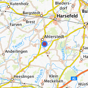
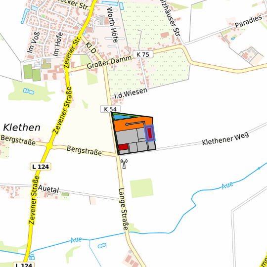
Industriegebiet Klethener Weg
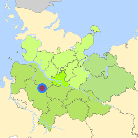
Municapility/city
Ahlerstedt
Parcel
Property size (m²)
6,991.87
Availability
immediately available
focus use
grassland
further use
unavailable
Legal planning situation
Commercial space secured by planning permission
Yes
Building area according to land use plan
commercial building area
Existing planning law
§30 BauGB (qualified development plan)
Type and extent of building and land use
Specific type of structural use
GIe
Development situation
fully accessible
24-hour operation
Yes
possible site occupancy ratio
0.8
possible floor area figure
Not fixed
possible number of full floors
Not fixed
possible height of building structures
12
cubic index
Not fixed
Exclusions/restrictions of land use
restrictions to mobilization
None
Infrastructur of site
broadband availability (at least 50 MBit/s)
Yes
quay edge
No
quay edge with sea-going vessel deep water
No
direct rail connection
No
electricity connection
Yes
gas connection
Yes
water connection
Yes
wastewater connection
Yes
Proprietary situation and marketing intention
proprietary situation
Public
Detailed information about commercial zone
Gross surface area (ha)
11.3039
Sector focus
mixed sector structure
Type of location of commercial estate
location for emission-intensive industry
classic commercial estate
Transport accessibility
Motorway
A 1
13.1
km
Motorway
A 26
19.0
km
Motorway
A 7
35.6
km
Main road
B 71
17.5
km
Main road
B 73
18.0
km
International airport
Flughafen Hamburg
57.9
km
International airport
Flughafen Bremen
66.9
km
Commercial airfield
Rotenburg (Wümme)
35.6
km
Commercial airfield
Weser-Wümme
47.8
km
Port
Seehafen Stade-Bützfleth
32.2
km
Port
Seehafen FHH
38.4
km
Rail freight traffic
Emons Spedition GmbH
49.8
km
Intermodal terminal
Industriebahnhof Stade-Brunshausen
29.5
km
Rail passenger transport
Harsefeld
8.0
km
Rail passenger transport
Bargstedt
8.8
km
Rail passenger transport
Ruschwedel
10.8
km
Rail passenger transport
Brest-Aspe
10.9
km
Rail passenger transport
Apensen
12.9
km
Public transport
Klethen Abzw. Klethen
0.7
km
Public transport
Klethen Abzw. Zevener Strafe
0.7
km
Availability of public transport
Limited available
Information about Ahlerstedt
GDP per capita (in €)
(district level)
30,977.00
Rate of unemployment (in %)
(district level)
6.40
Inhabitants of the municipality
5,151
Trade tax rate
410
Property tax B
420
Contact
Uwe ArndtGemeindebüro Ahlerstedt
Bürgermeister
Kakerbecker Straße 1
21702 Ahlerstedt
Contact
Uwe ArndtGemeindebüro Ahlerstedt
Bürgermeister
Kakerbecker Straße 1
21702 Ahlerstedt