GEFIS Gewerbeflächen-Informationssystem
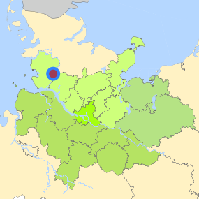
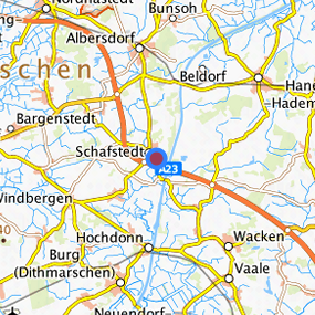
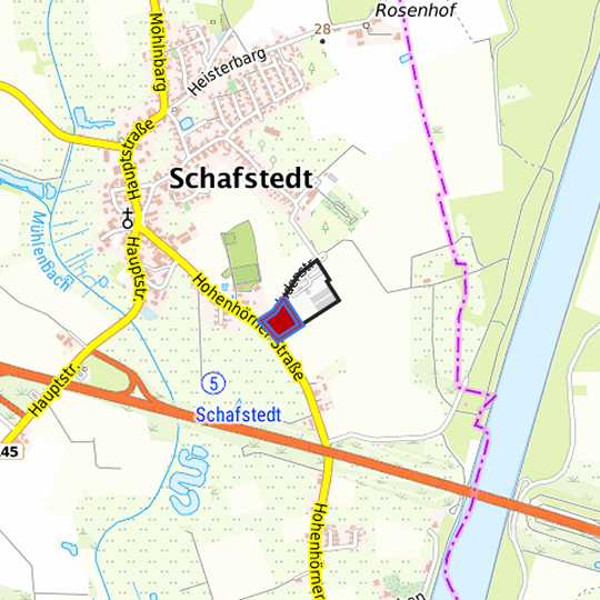
Am Aalbarg (Am Aalbarg) at Schafstedt, Kreis Dithmarschen
Legend
Availabilities
Immediately
short term (2 years)
medium term (2-5 years)
long-term (> 5 years)
optional area (bindingly reserved)
occupational pension plan
not available
Brief description
Description of the parcel
Am Aalbarg
Municapility/city
Schafstedt
Parcel
Property size (m²)
11,624.12
Availability
immediately available
focus use
agriculture
further use
unavailable
Legal planning situation
Commercial space secured by planning permission
Yes
Building area according to land use plan
commercial building area
Existing planning law
§30 BauGB (qualified development plan)
Type and extent of building and land use
Specific type of structural use
GE
Development situation
fully accessible
24-hour operation
No
possible site occupancy ratio
No information
possible floor area figure
No information
possible number of full floors
No information
possible height of building structures
No information
cubic index
No information
Exclusions/restrictions of land use
restrictions to mobilization
topography
Infrastructur of site
broadband availability (at least 50 MBit/s)
Not specified
quay edge
No
quay edge with sea-going vessel deep water
No
direct rail connection
No
electricity connection
Yes
gas connection
Yes
water connection
Yes
wastewater connection
Yes
Proprietary situation and marketing intention
proprietary situation
Private
Detailed information about commercial zone
Gross surface area (ha)
4.00
Sector focus
metal production and processing
Type of location of commercial estate
classic commercial estate
Transport accessibility
Motorway
A 23
1.5
km
Motorway
A 7
46.4
km
Motorway
A 215
54.7
km
Motorway
A 210
62.6
km
Motorway
A 27
63.7
km
Motorway
A 21
66.4
km
Main road
B 431
6.9
km
Main road
B 430
12.0
km
Main road
B 203
15.6
km
International airport
Flughafen Hamburg
78.8
km
Regional airport
Cuxhaven
74.8
km
Regional airport
Flughafen Lübeck
113.1
km
Commercial airfield
St. Michaelisdonn
21.5
km
Commercial airfield
Hungriger Wolf
27.3
km
Commercial airfield
Heide-Büsum
34.8
km
Commercial airfield
Neumünster
49.2
km
Commercial airfield
Hartenholm
60.2
km
Port
Binnenhafen Itzehoe
25.5
km
Port
Seehafen Brunsbüttel
28.5
km
Port
Landeshafen Büsum
34.3
km
Port
Seehafen Gückstadt
43.6
km
Port
Seehafen Rendsburg
44.0
km
Rail freight traffic
Emons Spedition GmbH
87.6
km
Intermodal terminal
Terminal Brunsbüttel (trimodal)
31.1
km
Intermodal terminal
Terminal Neumünster
51.5
km
Intermodal terminal
Terminal Cuxhaven (trimodal)
61.0
km
Rail passenger transport
Albersdorf
8.7
km
Rail passenger transport
Beldorf
11.0
km
Rail passenger transport
Burg(Dithm)
13.5
km
Rail passenger transport
Hademarschen
14.1
km
Rail passenger transport
Nordhastedt
16.3
km
Public transport
Schafstedt
0.9
km
Public transport
Schafstedt-Hohenhnrn
1.0
km
Availability of public transport
Available
Information about Schafstedt
GDP per capita (in €)
(district level)
32,837.00
Rate of unemployment (in %)
(district level)
5.10
Contact
Jörg-Peter NeumannEntwicklungsgesellschaft Westholstein mbH
Wirtschaftsförderer
Große Westerstraße 8
25746 Heide
Contact
Jörg-Peter NeumannEntwicklungsgesellschaft Westholstein mbH
Wirtschaftsförderer
Große Westerstraße 8
25746 Heide